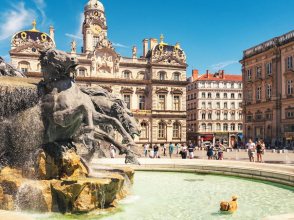
- Sustainable Tourism in Lyon
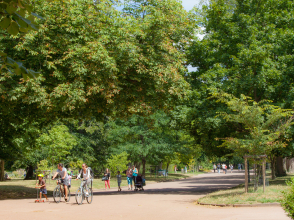
- Alternative means of transport
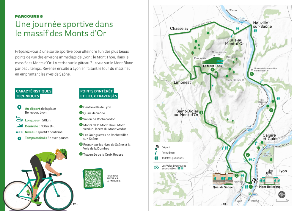
- Cycle tour 5 : a day of sport in the Monts d'Or
Cycle tour 5 : a day of sport in the Monts d'Or
A journey through the Lyon metropolitan area
Alternative means of transport
Last updated date : 02/10/2025
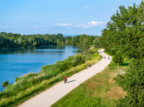
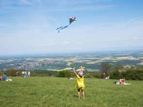
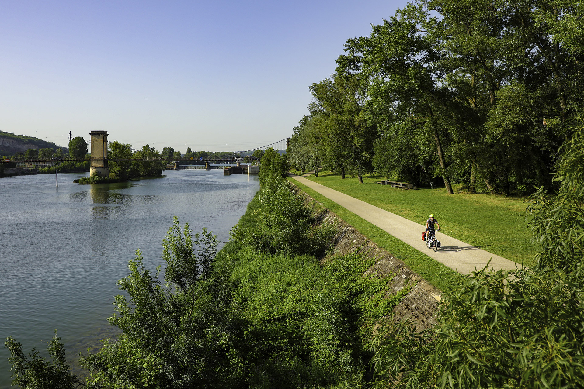
Prepare yourself for a challenging cycling trip up to one of the finest panoramic viewpoints of the area surrounding Lyon: Mont Thou in the Monts d’Or (a hilly area named after the golden colour of the local stone). When the weather is clear, you can even see Mont Blanc in the distance. The route takes you around the hills and back to Lyon along the banks of the Saône.
Guillaume Robert-Famy
See all pictures
Route specs
- 59% cycle paths
- Circular route, beginning on Place Bellecour, Lyon
- Distance: 50 kilometres
- Altitude difference: 700 metres' ascending elevation
- Level: sporty / experienced
- Estimated time to complete the route: 3 hours with breaks
- Departure and arrival: Place Bellecour
DISCOVER
Points of interest and locations along the route
This route offers a chance to explore the north-eastern part of the Lyon metropolitan area, via the valley of Rochecardon, the Monts d’Or (Mont Thou, Mont Verdun, the twisting roads of Mont-Verdun), and the guinguettes (lively little restaurants) on the riverbanks. It returns to Lyon along the Saône and the Voie de la Dombes walking path.
Map
©Grand Lyon
Route description
Starting on Place Bellecour, in Lyon city centre, embark on a 50-kilometre circular route, with 700 metres of ascending elevation, which will take you up into the hilly landscapes of the Monts d’Or, and to one of the finest panoramic viewpoints of the city, on Mont Thou.
First follow the Voie Lyonnaise 3 (VL3) along the banks of the Saône to the valley of Rochecardon, nestled between the towns of Champagne-au-Mont-Or and Saint-Didier-au-Mont-d’Or.
Steep and shaded, the Chemin des Rivières will take you up to the foot of Mont Thou, with one final push left to ascend it. At the top, at an altitude of 609 metres, the view stretches from the Lyon urban area to the peak of Mont Blanc. You will be able to see the high-rises of Part-Dieu, Fourvière Basilica,the plain of the Saône and Rhône, Bugey, the Pilat massif, and the Alps. This panoramic view is well worth the effort.
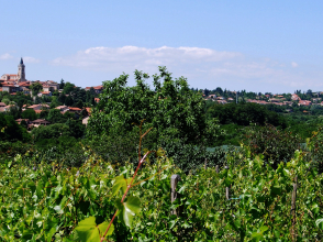
Mont Verdun, the highest point of the Monts d’Or and the Lyon urban area, rising to an altitude of 626 metres, is the second hill to climb. It offers views over the Monts du Lyonnais and the region to the west of Lyon. A pleasant ride down via the winding roads of Mont Verdun will lead you to Limonest town centre, which you will pass through before continuing the descent on your way north towards Chasselay.
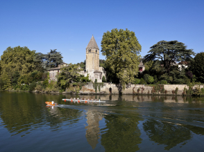
Back on the plain, the route will take you round the Monts d’Or to the north-east via Saint-Germain-au-Mont-d’Or and Curis-au-Mont-d’Or, before returning to the banks of the Saône in Neuville-sur-Saône.
You will ride along a marked-out section of the Voie Bleue cycle path, which links Lyon and Luxembourg along the rivers, before cycling back up to the plateau of Caluire-et-Cuire. The Voie des Dombes, a lovely green walking path that follows an old railway line, will take you back to the centre of Croix-Rousse, on the eponymous hill overlooking Lyon’s 1st district.
This final descent will lead you down to the peninsula between the two rivers and the square of Bellecour.
DISCOVER