- Discover
- The Metropole de Lyon
- 4 walks along the Saône
4 walks along the Saône
For a rustic jaunt with family or friends
The Metropole de Lyon
Last updated date : 22/04/2025
Are you taken with a craving for the countryside on a sunny day in the Lyon metropolitan area? Grab your walking shoes and soak up the splendour of the Saône with our pick of riverside routes.
See all pictures
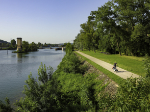
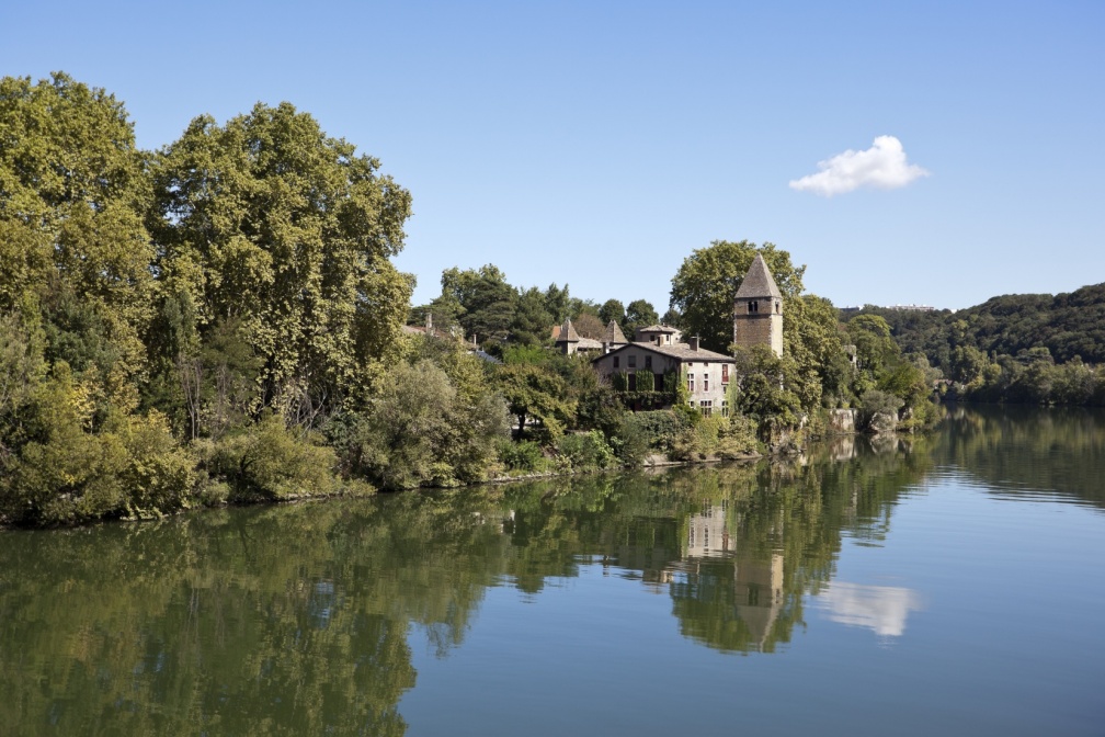
Banks of the Saône, Caluire-et-Cuire
Famous as the place where Jean Moulin was arrested on 21 June 1943, in the house of Doctor Dugoujon, Caluire-et-Cuire is also a town with abundant natural riches: the rivers Rhône and Saône border it on either side, a bucolic walking path runs through it, and it is dotted with green spaces, like Square Lassagne and Fort de Montessuy. This route will take you along a former railway line and the banks of the Saône, where you will find the mysterious Île Barbe – a small island filled with local legends – and its suspension bridge built in 1827, which connects Caluire-et-Cuire with the neighbourhood of Saint-Rambert.
- Distance: 9.4 km
- Time: 2 hrs 30 mins
- Elevation gain: 92 m
- Starting point: Dombes - Penthod
- Getting there: bus lines C1 - C13 - 33 - 38 - S5, stop ‘Cuire’
Fontaines-sur-Saône to Sathonay-Camp
This round walk will take you up and down the slopes of Fontaines-sur-Saône and Vallon du Ravin. Starting in Fontaines-sur-Saône, make your way to Sathonay-Camp – a town whose name and origins trace back to a military camp established in 1851 – and then up the banks of the Saône past the charming island of Île Roy and its pristine woods, populated by three remarkable wildlife species: the Eurasian beaver, the common kingfisher and the stock dove.
- Distance: 9.6 km
- Time: 2 hrs 50 mins
- Elevation gain: 151 m
- Starting point: Fontaines-sur-Saône - Place Carnot
- Getting there: bus lines 40 - 70 - 77, stop ‘Pont de Fontaines’
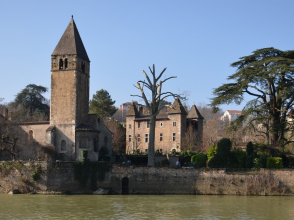
Place de la République, Rochetaillée-sur-Saône
Starting at Rochetaillée-sur-Saône, walk along the Saône and take the former towpath. A relic of the past, this riverside trail was once trodden by workhorses towing barges. The route will take you to Chemin de la Marinade, a lovely path lined with old oaks, and then further on to Musée Henri Malartre, a museum dedicated to vintage cars and motorcycles, and public transport in Lyon, situated in wooded grounds.
- Distance: 5.2 km
- Time: 1 hr 35 mins
- Elevation gain: 99 m
- Starting point: Rochetaillée-sur-Saône - Place Peyte
- Getting there: bus lines 40 - 70, stop ‘Rochetaillée’
Fleurieu to Neuville
Starting at Fleurieu-sur-Saône, named after its picturesque, flower-filled scenery, make your way along the banks of the Saône to Neuville-sur-Saône, then up to the hills of Fleurieu and its many havens of nature. At the end of the route, make sure you don’t miss the village church built in 1871 with yellow stone from Curis and Couzon.
- Distance: 6.7 km
- Time: 2 hrs 55 mins
- Elevation gain: 136 m
- Starting point: Fleurieu-sur-Saône - Le Bourg
- Getting there: bus lines 40 - 70, stop ‘Fleurieu’
Would you like to explore more routes in the Lyon metropolitan area? Try out some of the 50 signposted walking paths in the local area. You can also find more ideas for walks in the ‘Guide des sentiers nature’ (nature trails guide) and the ‘Carte Rando nature’ (nature walks map) provided by Greater Lyon.
What are you waiting for? Choose your next walk to explore the banks of the Saône!